PIS: J. Molina-Carpio and F. Satgé
[Contacts]
- Fréderic Satgé: frederic.satge@ird.fr
- Jorge Molina C.: jamolinacarpio@gmail.com
Highlights:
- Drivers/forcings of the Altiplano hydroclimatic variability.
- Mechanisms and processes responsible for the water crisis.
- Impact of climate and land use changes on the Altiplano hydro-system
Abstract:
WP3.2 aims at evaluating the impact of hydroclimatic variability and expected changes on the water system and population of the Altiplano. It will rely on ground and remote sensing hydroclimatic observations to study the drivers of the current variability and the processes responsible for the water crisis. A hydrological model will be calibrated to assess the respective role of climate change and land use land cover (LULC) dynamics on the Altiplano water resources. This research will identify the drivers and trends of the Altiplano hydroclimatic variability and provide scenarios for the water management and the analysis and implementation of resilience strategies (WP3.3).
Associated projects:
WASACA
This project aims to support a sustainable agriculture adaptation to climate change over the Altiplano. By the extensive use of remote sensing data and machine learning models the project has developed a monitoring system of salinization in the central Altiplano. Furthermore, WASACA project has initiated a hydrological modeling-based approach (i.e. fixing changing method) to assess the respective role of climate change and land use land cover (LULC) dynamics on the Altiplano water resources.
Contact: Fréderic Satgé: frederic.satge@ird.fr

IRN-ANDES-C2H
The International Research Network – ANDES Climate-Cryosphere-Hydrosphere (ANDES-C2H IRN) aims to bring together scientists from different French and South American institutions whose research focuses on the study of the dynamics of the water cycle and associated environmental changes, in interaction with climate forcings and changes in surface conditions, along the Andes.
Contact: Thomas Condom: thomas.condom@ird.fr

ANDEX
It is the Regional Hydroclimatic Program for the Andes dependent on the Hydroclimatology Panel of the Global Energy and Water Exchanges Program (GEWEX), one of the central projects of the World Climate Research Program (WCRP). ANDEX general objective is improving the understanding and prediction of the climate and hydrology along the Andes.
https://www.andex-rhp.org
https://www.gewex.org/project/andex/
Contact: Jhan-Carlo Espinoza: jcev09@gmail.com

QUIMONOS – 1
The project aims to estimate soil properties (salinity, total carbon, nitrogen, pH, texture, and moisture) using Sentinel-2 multispectral imagery, with the objective of assessing the sensitivity of agricultural yields to soil conditions. This information will help identify and promote sustainable agricultural practices in a context of increasing water scarcity and climate change.
Contact: Fréderic Satgé: frederic.satge@ird.fr
COMOS
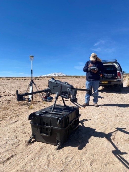
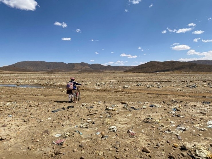
The project aims to monitor soil contamination by microplastics and heavy metals using spectral signatures obtained from drones, satellites, and spectroradiometers. These tools will enable an initial regional assessment of soil contamination and pave the way for spatiotemporal monitoring to understand contamination dynamics and identify measures to limit its spread in the environment and reduce its impacts on agriculture and the ecosystems of the Altiplano.
Contact: Fréderic Satgé: frederic.satge@ird.fr
QUIMONOS – 2
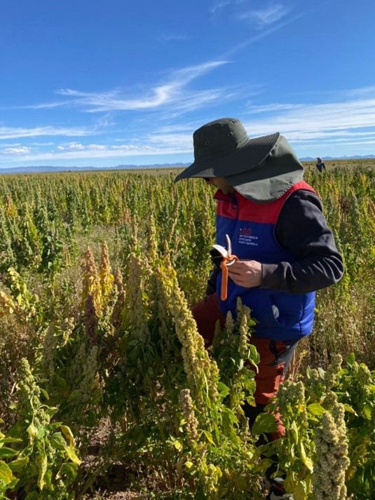
The project aims to monitor quinoa crops using drone and satellite imagery, employing spectral signatures to characterize their condition. It also seeks to estimate yields at an early stage as a tool to anticipate potential food and economic crises, and to assess the effects of agricultural practices on yields in order to identify more sustainable practices.
Contact: Fréderic Satgé: frederic.satge@ird.fr
AgroPulse
The project aims to develop an application that enables farmers to assess the fertility of their plots before sowing, using indicators such as salinity, carbon, nitrogen, pH, texture, and moisture. The results will be presented spatially at a 10 m resolution to identify areas with fertility problems and guide improvement measures. Based on the assessment, the application will propose specific solutions using a catalog of available bio-inputs, with the aim of improving soil fertility and crop productivity.
Contact: Fréderic Satgé: frederic.satge@ird.fr